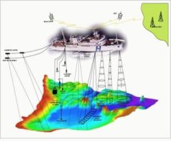
| Hydrographic Surveys IHO Member States have a fleet of about 400 hydrographic survey vessels, numerous hydrographic launches, support helicopters, and aircraft equipped with laser survey equipment. Surveys include bathymetry (soundings), land topography, and oceanographic measurements (e.g. tides, currents, waves). Soundings (depth measurements) are primarily acquired using single and multi beam ship mounted echo sounding equipment (sonars), however, in shallow coastal waters, aircraft mounted laser echo-sounding equipment, is also being used for the rapid collection of bathymetric data. Most survey data is collected in digital form which facilitates the creation of data bases that are used to generate navigational products such as nautical charts, bathymetric maps and customized GIS products.
|
- You are here:
-
Home

-
About IHO
-
Activities
- Hydrographic Surveys
Hydrographic Surveys
- Details